
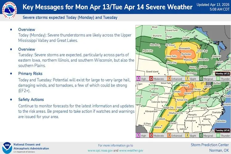
The National Weather Service says this could be a potentially stormy week in the tristate area with numerous chances for strong to severe storms across the region.
Forecasters say the stronger storms could begin firing starting later tonight with the Storm Prediction Center putting the area on the edge of a slight, to marginal threat for severe weather.
Tomorrow the chance elevates to an enhanced risk of 3 of 5 threat across the entire area. All forms of severe weather including isolated tornadoes will be possible today and tomorrow so make sure you have multiple ways to receive potential warnings.
Forecasters say more severe weather is possible again Wednesday and also on Friday.
CLICK HERE for link to National Weather Service Severe Weather Briefing