Numerous severe storms tracked across Eastern Iowa, Northwest Illinois, and southern Wisconsin on Friday afternoon and evening. Widespread wind gusts between 60-70 mph, large hail up to teacup size, several tornadoes and 1 to over 3 inches of rainfall were reported around the area.
The most significant damage reported in the Tri-State so far area occurred in northwest Illinois in Jo Daviess and Stevenson Counties.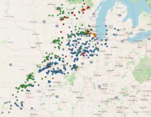
The community of Lena saw extensive damage with many homes and outbuildings damaged, trees uprooted, and power lines downed. Initial reports of some deaths in Lena have been refuted as Stevenson County authorities say they are not aware of any fatalities and no serious injuries have been reported at this time. Authorities are asking the general public to avoid the area to allow first responders to their jobs. The Stevenson County Sheriff is expected to give a press conference update later this morning.
In Jo Daviess County dispatchers reported a communications tower was downed near Elizabeth. There were also multiple reports of up to golf ball sized hail from Galena to Elizabeth and in Hanover. The Stockton area also reported significant wind damage.
In Eastern Iowa a possible tornado was reported at south Iron Hills, just northwest of Maquoketa where power lines were snapped and a sheet metal roof was torn off a building. Near Cascade an 86 mile per hour wind gust was recorded along with one inch hail.
In southwest Wisconsin there were many reports of up to one inch hail falling.
The National Weather Service says storm survey teams will be assessing the damage throughout the region this weekend and likely into next week in collaboration with county emergency management to determine the extent of the damage.
CLICK HERE for the latest storm reports from the National Weather Service